- “Bringing The Past, Into the Future”
- +44 (0) 1204 388754
£7.00
Jersey (2003)
The Geology of Jersey, Channel Islands by A.C.Bishop, D.H.Keen, S.Salmon & J.T.Renouf
The rocks of the island are well displayed in coastal exposures, and the clean, wave polished surfaces are ideal for studying rock relationships and textures. The 9 itineraries cover most of the island’s geology – metamorphic and igneous rocks, plutonic intrusions, etc. of the Cadomian Orogeny – in coastal sections. Emphasis is placed on safety (state of the tides) and whether the sites are RAMSAR (Wetland) sites with restrictions.
Jersey (2003)
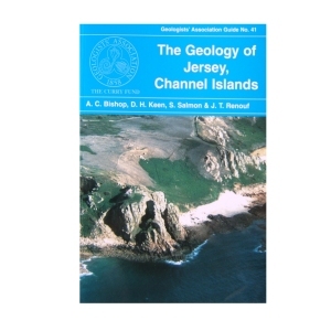
The Geology of Jersey, Channel Islands by A.C.Bishop, D.H.Keen, S.Salmon & J.T.Renouf
The rocks of the island are well displayed in coastal exposures, and the clean, wave polished surfaces are ideal for studying rock relationships and textures. The 9 itineraries cover most of the island’s geology – metamorphic and igneous rocks, plutonic intrusions, etc. of the Cadomian Orogeny – in coastal sections. Emphasis is placed on safety (state of the tides) and whether the sites are RAMSAR (Wetland) sites with restrictions.
| Weight | 200 g |
|---|
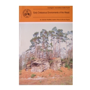
Early Cretaceous Environments of the Weald (1996)
by Alastair Ruffell, Andrew Ross & Kevin Taylor
In order for the Guide not to become out-of-date it concentrates on exposures that are likely to remain in their present state for some time, thus some abandoned sites are omitted. The interested geologist will find the locations easily, observe the main features with no trouble, and be able to do this for some years to come.
Out of stock
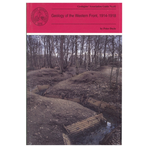
Geology of the Western Front (1999)
by Peter Doyle
Geology and topography of the battlefields of France and Belgium had an important role in determining the character and the outcome of many of the most famous battles. This Guide is intended for all people with an interest in the British sector of the Western Front and, although geological terms are included, they are kept to a minimum and those that are deemed essential are included in a glossary at the end of the guide.
2 in stock
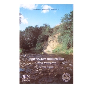
Onny Valley, Shropshire, Geology Teaching Trail (1992)
by Peter Toghill
The Onny Valley, provides a classic and famous section through the Caradoc Series and along it are exposed all the characteristic rocks varieties containing their wellknown shelly faunas. The trail guide is meant to appeal to students, ndergraduates, as well as amateur geologists. The general public will find something to interest them too, as the trail follows a beautiful wooded valley, with plenty of wildlife to see.
Out of stock
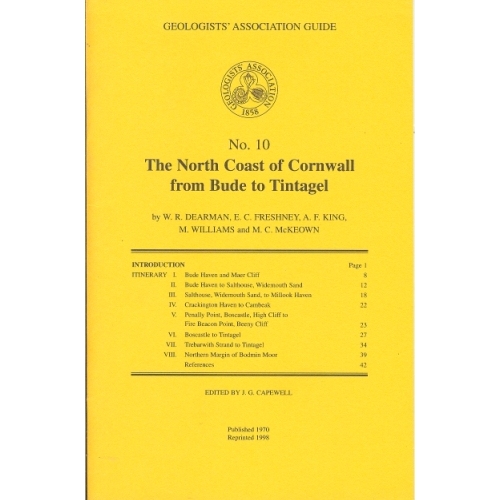
North Coast of Cornwall (1970)
The North Coast of Cornwall from Bude to Tintagel (1970)
by W.R.Dearman, E.C.Freshney, A.F.King, M.Williams and M.C.McKeown
The itineraries described in this guide have been designed to illustrate the stratigraphy and structure of a long coastal tract of Devonian and Carboniferous rocks. As some aspects of the coastal structures are to be related to granite intrusion, one itinerary deals with the northern part of the Bodmin Moor granite and its envelope.
Out of stock
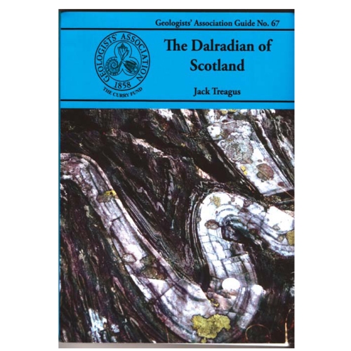
Dalradian of Scotland
Jack Treagus (2009)
The Dalradian Supergroup of mainland Scotland occupies most of the area generally known as the Grampian Highlands, geographically bounded by the Great Glen Fault to the north and the Highland Border Fault to the south. The Dalradian of Scotland offers the greatest variety of metamorphic rocks to be found in the British Isles. There are sedimentary rocks ranging in composition from limestones and mudstones to conglomerates, often with beautifully preserved sedimentary structures providing evidence of the depositional environments.
Out of stock
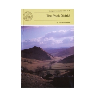
The Peak District (1999) by F. Wolverson Cope
This is the third edition of this Guide and although there have been changes in classification etc. the general exposures are as good as they used to be. Most of the itineraries in this Guide have specific locations marked on accompanying sketch maps. Where greater precision is needed grid references are given.
Out of stock
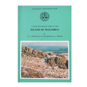
Mallorca (1990)
Island of Mallorca by H.C.Jenkyns, B.W.Sellwood and L.Pomar
This guide is primarily designed to be used by those travelling by car, based in Palma. Each of the 6 excursions covering Triassic facies and tectonic style, drowned Carbonate platforms, redeposited Oolites and Jurassic pelagic facies, platform Carbonates, pelagic sediments and black shales, paleogene non-marine Limestones and lower Miocene reefs and Turbidites, Messinian reef facies, proximal redeposited Carbonates and Messinian post-reef oolites and Stromatolites is very full and if taken in the winter may not be completed in daylight!
Out of stock
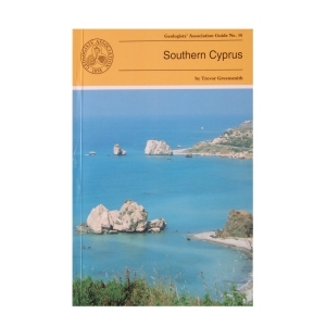
Southern Cyprus (1994) by Trevor Greensmith
This Guide is to some of the more accessible outcrops in Southern Cyprus, including those of the world famous Troodos (Troodhos) Range. It is designed to give the questing novice in the subject of Geology a glimpse of the wide variety of igneous, sedimentary and occasional metamorphic rock types and rock structures which constitute this section of the island and explain the significance of what can be seen at any given locality. Many technical names have had to be introduced which are explained in the glossary.
2 in stock
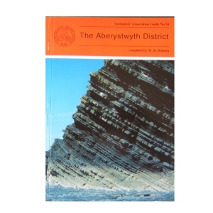
The Aberystwyth District (1995)
compiled by M.R.Dobson
The Aberystwyth Grits and Borth Mudstones (Silurian) are magnificently exposed in accessible cliffs along the coastline of Cardigan Bay and are world-famous as classic examples of turbidity current deposition. But the region is also known for the variety of its glacial landforms and modern sedimentary environments . Nineteen itineraries are described in detail, the first eight dealing with the variations in the turbidite fan succession between New Quay in th south and Harp Rock in the north. The rest cover the Dovey Estuary, the Quaternary and solid geology of Cardigan Bay and the Plynlimon area. A glossary is included.
2 in stock
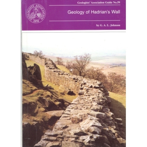
Hadrian’s Wall (1997)
Geology of Hadrian’s Wall by G.A.L.Johnson
The geology of Hadrian’s Wall falls naturally into three sectors: in the East the wall is over Upper Carboniferous Coal Measures and Millstone Grit; the Central Section is underlain by Lower Carboniferous intruded by the Great Whin Sill and in the Western sector the Wall crosses the New Red Sandstone. Glacial drift is widespread. All three sectors are described with specific sites in detail.
Out of stock
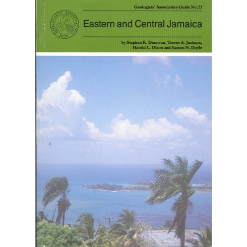
Eastern and Central Jamaica (1995)
by S.K.Donovan, T.A.Jackson, H.L.Dixon & E.N.Doyle
The oldest rocks in Jamaica are Cretaceous with the succession dominated by andesitic volcanic rocks with associated limestones representing an island arc system. The principal features of the geology of the island are described followed by ten itineraries which illustrate at outcrop the variety of the Cretaceous to Recent rocks including granite-like intrusions, volcanic lavas and altered ashes, mineral deposits, highly fossiliferous limestones and shales, and economically important bauxites. Car hire is recommended.
1 in stock
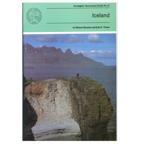
During the last 16 million years (up to recent times) igneous rocks with a variety of compositions have been extruded and then moved E or W of the rift valley which marks the central line of the Mid-Atlantic Ridge The ice sheets and their associated glaciers formed by the accumulation of snow over hundreds of years, occupy 11% of Iceland. The pressure on water trapped in geothermally heated cavities close to the land surface is occasionally relieved generating Geysers. The itineraries in the Guide provide a representative selection of sites of the above.
Out of stock
Reviews
There are no reviews yet.